RSIT
Earthquake alerting based on spatial geodetic data by spatiotemporal information transformation learning
Welcome to RSIT: Earthquake Alerting
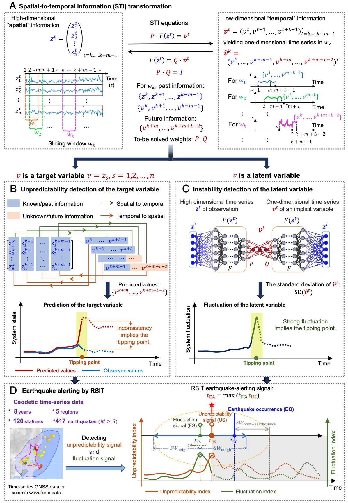
Alerting imminent earthquakes is particularly challenging due to the high nonlinearity and nonstationarity of geodynamical phenomena. Based on spatiotemporal information transformation (STI) for high-dimensional real-time data, a model-free framework, i.e., real-time spatiotemporal information transformation learning (RSIT), is developed for extending the nonlinear and nonstationary time series. RSIT explores both the spatial and temporal dynamics of real-world data on the basis of a solid theoretical background in nonlinear dynamics and delay-embedding theory.
